 |
|
||||||||||||||||||
| Download the revised decree and electoral calendar, published in the official journal |
 |
|
|
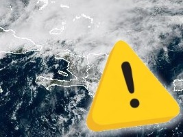
URGENT : Yellow Alert - Risk of severe weather in Haiti 24/04/2026 15:09:20
Rain and thunderstorms remain a threat, particularly in the far north and the rest of the country, late in the day and into the evening. Haiti's Hydrometeorological Unit forecasts risks of flash flooding and landslides in several areas of the north, northeast, and northwest. The cold front, whose portion affecting Haiti is weakening, continues to influence local weather conditions, maintaining unsettled weather along its path, with variable cloud cover. The instability associated with the tail of the front, combined with the advection of a slightly humid flow over the southern regions, is already causing rain in the Upper Artibonite, the Lower Northwest, and some localities in the South. These showers, potentially thundery, are expected to intensify and gradually spread across almost the entire country during the afternoon, evening, and possibly overnight in some areas. These rain and thunderstorms are forecast to be more intense in the far north. Rainfall totals of 100 to 200 mm are expected in the Far North over 24 hours, potentially exceeding 250 mm in mountainous areas, accompanied at times by wind gusts of 20 to 40 km/h. Given the already significant level of soil saturation and considering the forecast of intermittent, sometimes heavy, rainfall, particularly in the Far North this afternoon, with the possibility of persisting into the night, which could cause flash floods and landslides, the Hydrometeorological Unit of Haiti (U.H.M.) of the Ministry of Agriculture, Natural Resources and Rural Development (MARNDR), in conjunction with the General Directorate of Civil Protection, is issuing a warning. The General Directorate of Civil Protection (DGPC) and the National Disaster Risk Management Plan (SPGRD) maintain the YELLOW alert for "heavy rain" for the Northwest, North, and Northeast departments this Friday, April 24, 2026. A gradual improvement is expected starting overnight in the Far North, while the Far South could experience a wet morning on Saturday, April 25, 2026, in some areas. Safety Guidelines for the Public Here are the measures that residents of flood-prone areas should follow : - Preventive Evacuation : If you live by the sea, near a ravine, or in an area that is usually prone to flooding, make arrangements to take shelter with a relative or friend. - Crossing Waterways : Never cross flooded water, whether on foot, on horseback, or by car. - Protecting Documents : Put your belongings and important documents in a safe place, away from water. - Lightning Precautions : In case of a thunderstorm, do not stay under trees, near poles, or near any equipment that could attract lightning. - Official Information : Do not believe rumors; follow weather forecasts and the directives of state authorities. HL/ HaitiLibre
|
|


|
Why HaitiLibre ? |
Contact us |
Français
Copyright © 2010 - 2026 Haitilibre.com |